
When I purchased my airplane in August 2022, the goal was to build up PIC (Pilot In Command) hours for my Canadian Airline Transport Pilot License. I figured it would be more challenging and rewarding to do some long-range trips instead of just flying around the all too familiar city where I live, Winnipeg MB. Canada being the world’s second largest country certainly provides one with several destinations and a vastly different landscape.
I got in touch with Tyler, a pilot friend of mine back from my early days of flight school. We had not seen each other in years and so I decided to pay him a visit by flying to Edmonton.
I wasn’t very familiar with his home province of Alberta so we texted back and forth a few ideas as to where to do some scenic flights. Jasper National Park and the Rocky Mountains were the first option, however wind was forecasted to be strong and turbulence would likely have made it unpleasant. Tyler then texted:
“Slave Lake is a good airport... We can keep going north to Northwest Territories to say we’ve been.”
It was a funny idea. Adding 285 nautical miles (530 kilometres) to the trip just to say we have been to a Canadian territory certainly would be worth the bragging rights.
“Let’s do it!” – I said in excitement and because I really needed the hours anyway.
PLANNING AN EXPEDITION
The idea evolved from just landing at a Northwest Territory (NWT) airport and coming back to Edmonton in the same day to a full trip and overnight stay in Yellowknife. As the capital city of NWT, there were decent attractions worth visiting. The city also had a special meaning for me and my family, my cousin was an international student there and that helped me choose Canada when I was deciding where to immigrate years ago.
Planning this trip, I had two major risks to account for: weather and remoteness.
Weather: In mid-October the temperatures in the NWT were already getting close freezing and Yellowknife particularly was forecasted to stay around 0 °C. Although this is still ‘warm’ to the severe winter yet to come, it means it’s prime season for aircraft icing. As a small airplane, my Piper Cherokee does not have any system to fight off icing. Encountering icing could be dangerous in the air and if it happened on the ground we would be stuck where we landed – foreshadowing.
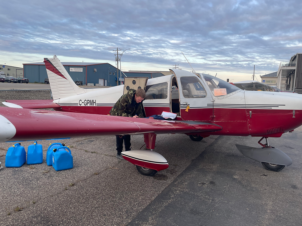
Remoteness: At 1.3 million square kilometers, the NWT are only a little bit smaller than Mongolia. Yet only 40,000 people live there and half of them are in Yellowknife. As a result, there aren’t many communities, roads or airports to land at. Risk assessment should be in the mind of every pilot on every flight. For this flight specifically I kept asking myself “if we had an engine failure and had to make an emergency landing, would we be stranded from civilization? Could we survive until rescue comes?” To increase our chances of survival in this worse case scenario we decided to follow the few existing highways in the NWT. If we had an emergency we would simply land on the highway and be found by traffic passing by. I also brought jerry cans to put inside my plane, they could store up to 2 hours of fuel for greater flexibility in our trip – never trust the north.
The planned itinerary became the following:
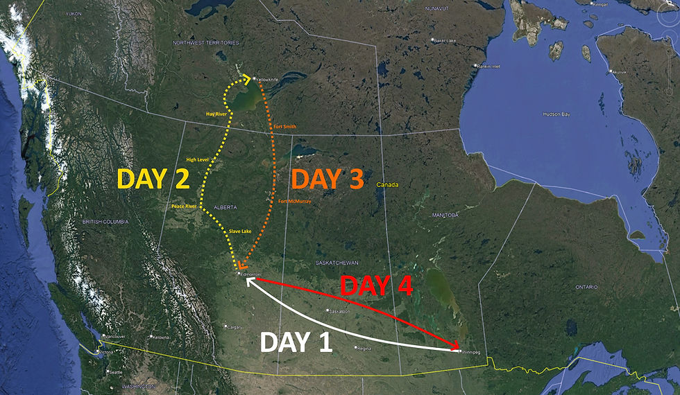
DAY 1
Leave Winnipeg (CYAV), my home base, and go to meet up with Tyler at the Edmonton Villeneuve airport (CZVL), fuel stops on the most convenient places along the way.
DAY 2
Depart from Edmonton and reach Yellowknife by the end of the day. Stops in Slave Lake, Peace River, High Level and Hay River.
DAY 3
Leave Yellowknife back to Edmonton to drop off Tyler. Stops in Fort Smith and Fort McMurray.
DAY 4
Return to Winnipeg, inverse route of day 1.
In total it was a 2,600 nautical mile (4,800 kilometers) round trip, there was a lot of flying to be done!
FLYING NORTH
Weather in Winnipeg was BAD. I was supposed to leave on October 13 (Thursday), but it was an IFR (Instrument Flight Rules) day and was forecasted to continue as such until Sunday. If this was the case, I wouldn’t be able to do the trip as Tyler only had the weekend available due to his work. For a miracle the skies opened up just enough that I could do a VFR (Visual Flight Rules) departure.


The beginning to my longest flying journey was on!
Upon reaching the western portion of Manitoba the weather had mostly cleared up and it was smooth flying ahead. I was using my iPad for the most efficient route to Edmonton and made a fueling stop in Wynyard SK using my jerry cans. I also stopped in Vermillion AB to get some gas, they did have an attractive fuel price. Thanks for the info Foreflight!

Vermillion was remarkable, they had a grain silo 4,300 feet perfectly lined up with runway 10. This airport will never see an IFR approach!
At midnight I arrived at the Edmonton Villeneuve airport. I was greeted by Tyler and stayed at his place in the outskirts of Edmonton. Early Saturday morning we were back at the airport making the final preparations before the expedition. We met up with Jasmine, a friend of Tyler that would join us in the trip. We departed with full fuel, 5 hours endurance, and an extra 2 hours of fuel on jerry cans. Going to a new destination was exciting!
We set course northbound, the urban landscape started to gradually change to ever to smaller towns, more farmland and eventually reaching the woods that we at their prime autumn colours. In order to save up time, we decided to bypass landing at Slave Lake. We wanted to get in Yellowknife early to make most of our time and explore the town. We landed in Peace River to stretch legs, check fuel levels manually and used half of the jerry cans.

North of the Peace River the landscape started to change, there were fewer farms and more woods. They looked like a depressing dark grey, a sign of the desolate northern lands we were about to head into? We were jokingly trying to spot Canada’s northernmost farm, likely just when we were flying by High Level. We opted to bypass it too and go directly to Hay River in the interest of saving time.

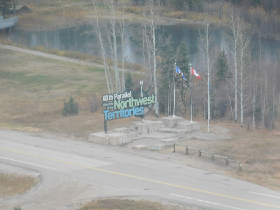
At this point there were some low ceilings which forced us to fly only a few thousand feet above ground. Altitude is a pilot’s friend, it gives you time and options if an emergency were to happen. Since we were restricted to flying low, we religiously followed highway 35 northbound. If something were to happen the highway is a possible landing strip. We also had the nice benefit of getting the proper greeting when crossing the border into the Northwest Territory!
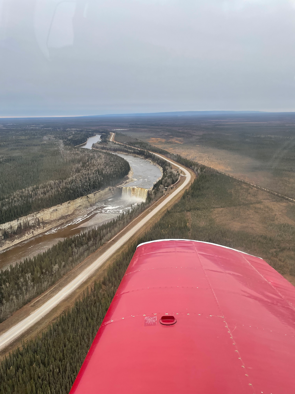
I never imagined I would be breaking my latitude record on my own plane and there were more reasons to celebrate. Shortly after entering NWT we had the amazing sights of the Alexandra Falls and the Hay River canyon.
We continued following the highway to the town of Hay River. We landed and I was just about to park by the fuel pumps, the airport guy kindly informed me though that the fuel pump was not self-serve. Not a big deal, I had checked fuel prices earlier and the fuel here was considerably cheaper than in Yellowknife. I then read some of the saddest words in my life at the fuel pump sign: “$150 call-out fee.” Just like that, the good deal was gone.
I knew doing a long flying trip was going to be expensive, but I do enjoy saving money when it doesn’t affect safety. I checked fuel levels, added the remaining jerry cans, did some math and the numbers made sense: we can still make it to Yellowknife with a good safety buffer!
And so, we took off on runway 32 heading directly towards the Great Slave Lake. Yellowknife was on the other side of the lake, but it was simply too massive just to fly over it legally. There are regulation to flying over water and basically if you cannot glide to the shore you shouldn’t be flying that far out! We changed course to follow the western shore of the lake to our destination.
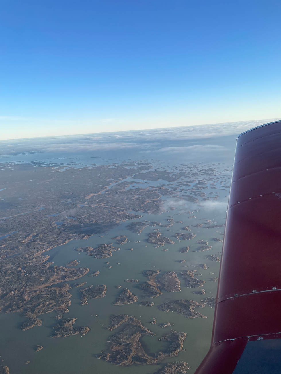
While flying over it, my passengers didn’t appreciate when I pointed out this was the deepest lake in North America. Nor when I said if we crashed and our bodies didn’t sink, we would visit the Artic Ocean for free as they would be carried downstream. There’s always a positive angle!
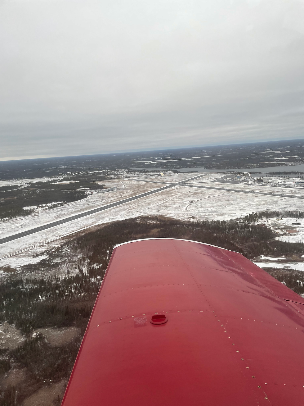
Just over one hour in this last leg we were able to spot Yellowknife appearing in the midst of clouds ahead. It was a relief to see this city shining through the horizon after the all the remoteness we flew over, a true beacon of civilization in the land of nothingness!
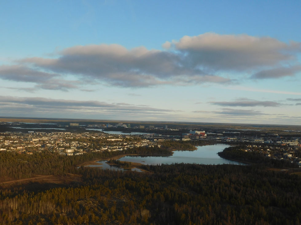
We landed at one of the airport’s massive runways and went straight ahead to the FBO to park the plane and leave it for the night on the ramp. We made it just in time to get a rental car from the airport before the agency closed down. We made the journey and now the city was ours to explore!

The coolest license plate in Canada.
BRIGHT LIGHTS
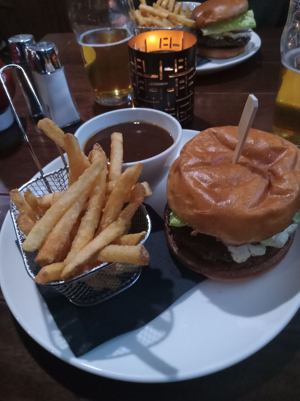
Necessities came first and all of us had a bison burger to celebrate the trip before going to the hotel. The gravy-to-fries ratio was extraordinarily high at The Monkey Tree Pub.
At night we were resting at the hotel but Tyler couldn’t stop talking how he wanted to see the northern lights. We checked the forecast and there was a 45% chance of seeing them. “Fine, let’s go out of town to get a better view” I said.
We drove through highway 4 to the Yellowknife River Park and sure enough, the northern lights were there. Fade at first, the green aurora strengthened to a moderate level and remained for 1 hour on the clear night skies. I can see why tourists, particularly the Japanese, spend 10 to 15 thousand dollars to come see these lights in winter. It increases the chance of good luck and for a baby to be born a boy, so I was told. This truly was the icing on the cake for our trip, we returned to the hotel and went to sleep hoping for a 10 am departure back to Edmonton.


HERE COMES THE SNOW
When I woke up at 7:30, my first instinct was to open the window and look outside. The sun had not risen yet, the city was dark but covered in white – it had snowed overnight. “The airplane is iced up!” I thought to myself, realizing we wouldn’t be able to leave in the morning.
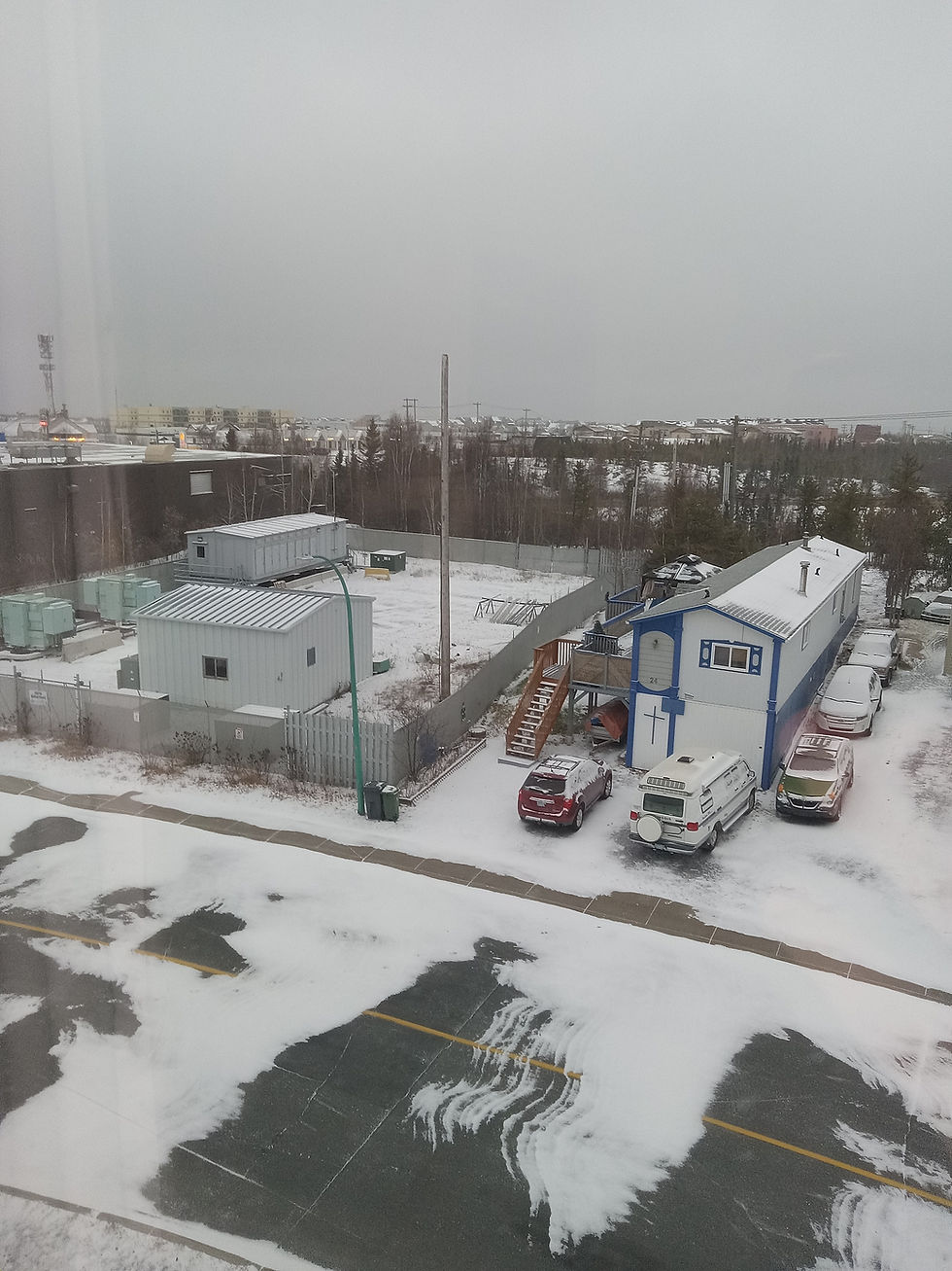
I checked the weather forecast and sure enough, it was supposed to warm up to 2°C in the afternoon so the ice should melt by then. I called the FBO to say we would depart in the afternoon due to weather. We had low visibility, low ceilings, a windy morning and a frozen airplane – the perfect opportunity to go explore the city in the morning!
We set off first to the Bush Pilot’s Monument. Not too far from downtown, it sits on a rock looking over the Yellowknife Seaplane base and the iconic boathouses found on Yellowknife Bay. The monument was erected to honour the pilots who flew through incredibly hash conditions in the early days of the town to connect it with the remainder of civilization. Flying over all this remoteness is already challenging today, image doing it on the 1920 and 1930s…


The monument is perfectly situated between Old and New Yellowknife. To the north we saw the older houses from the town’s early beginnings while on the south we could see the buildings from the city’s downtown. The scenery was remarkable, Yellowknife sits on the Canadian shield, a geologic formation featuring several bedrocks exposed on the surface. As a result, the roads we drove over we’re frequently uneven, on a slope and the local architecture reflected that.
Our next stop was the Prince of Wales Northern Heritage Centre. Admission was free and included exhibits on both the history of the local peoples of the NWT, the expansion of the Canada into the area and the local wildlife. This is definitely a must-visit if you are in town. We also checked out the Legislative Assembly located beside it.


Overall Yellowknife was a welcome change in scenery in the midst of all the remote lands. The city had more amenities than what I expected: car dealerships, chains like McDonalds and Starbucks, full-on grocery stores. Maybe this is what happens when the city is rich from all the gold and diamond mines around? Even more surprising was that the prices of groceries are the same compared to major Canadian cities. In northern Manitoba, where I travel for work, it’s a completely different story.
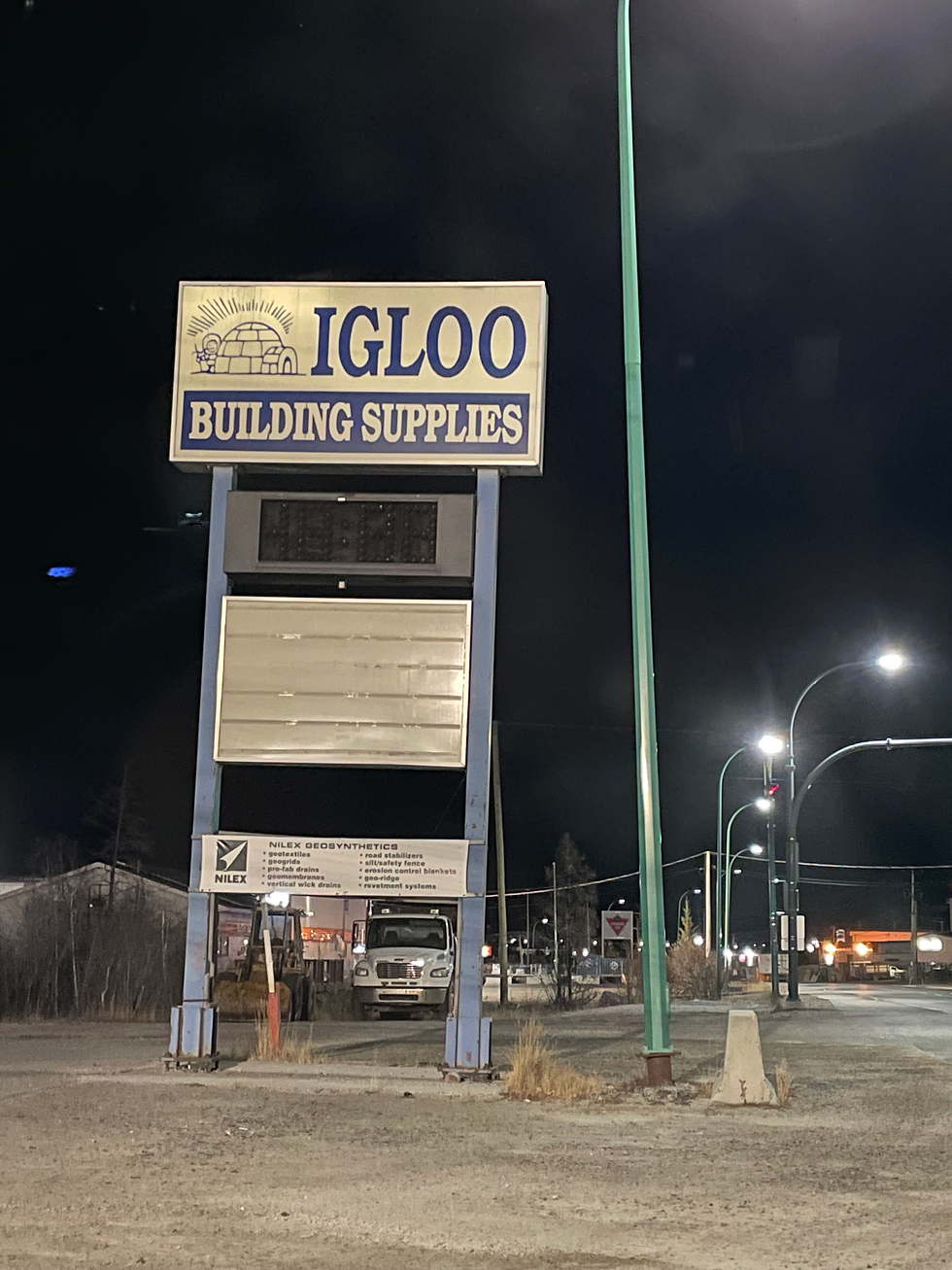
The ultimate proof that Canadians live in igloos.
As much as we enjoyed this city of 20,000 people, there was only so much to do and we had to start making our way back to Edmonton.
DE-ICING
We got back to the airport at 15:00 and found the plane covered with ice. Propellers, tail and half of the wings had a sheet of ice from the earlier snowfall and the 0°C temperature. These are all critical surfaces and taking off with ice contamination would be both dangerous and illegal. There are different ways of de-icing an aircraft but they do become expensive where you use de-ice fluids or pay to have the aircraft go inside a heated hangar.
As I was trying to save money I was hoping the above freezing temperatures and sunshine would help get the job done, but these weren’t happening fast enough. A simple and cost effective solution was found by the ramp agent: lots of extension cords and a heat gun! I then proceeded to melt off and dry all the ice on the critical surfaces. Another win for owning a small and low wing airplane!

It took one hour but I saved hundreds of dollars by using this method de-ice pads don’t want you to know.
RETURN TRIP
The weather had improved just enough for a VFR departure from Yellowknife. We had a low overcast layer and since we couldn’t climb very much we scrapped the idea of following the eastern shore of Great Slave Lake to Fort Smith. That side of the lake does not have a highway or any trace of civilization, if clouds lowered or we had an emergency we would be in a tough spot. As such we departed the city westbound following the highway on the same route we came the day before.


One hour southwest bound we soared through clear skies under warm rays of sunlight - a welcome change! We flew directly to High Level in order to make a fuel stop while witnessing sunset on the way just as we crossed the border into Alberta. We had phoned the fueling company ahead of time to make it an efficient fuel stop. Upon landing we had a one hour delay as it was the fueler’s first day at work and there were some problems with the fuel machine. Once things were done we did a straight shot night flight back to Edmonton Villeneuve arriving at midnight. Tyler and Jasmine were home at reasonable time to work the following day.
I was to return to Winnipeg the following afternoon, but first I had to make a stop on the city’s most iconic landmark:
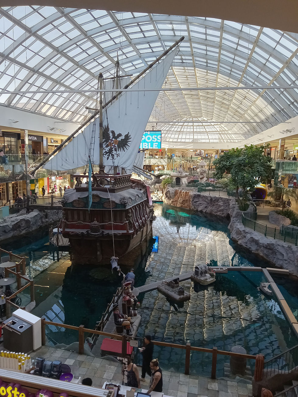
West Edmonton Mall is the largest mall in North America and for all intents and purposes it has everything: ice skating rink, waterpark, gun shooting range, mini-golf, aquarium, hotels and tons of stores. My only goal in the visit however was to buy some electronics and take advantage of Alberta’s lack of sales tax - it’s my favourite Canadian province for a good reason!
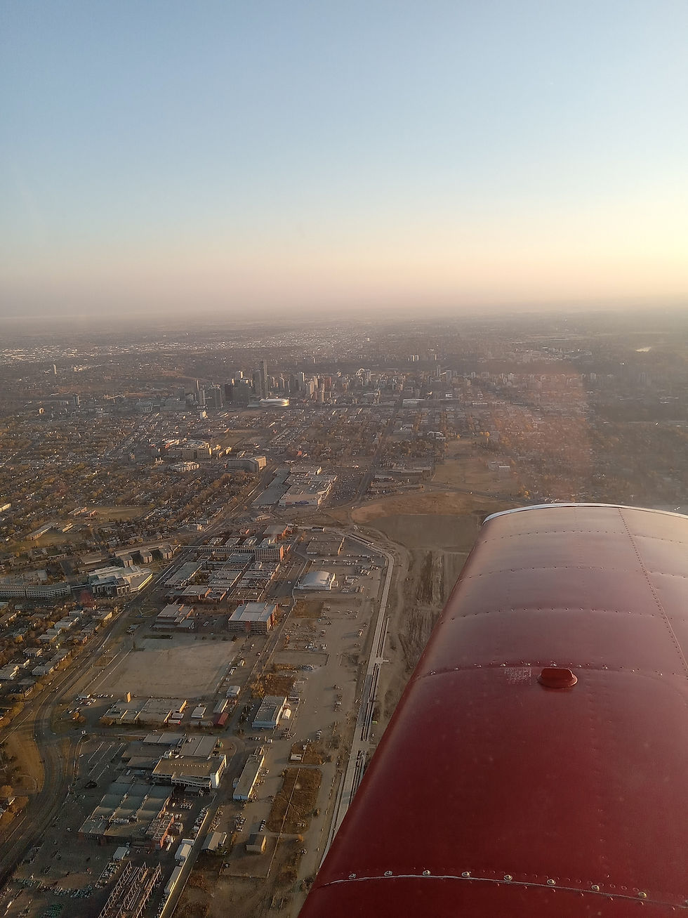
Later in the afternoon I departed the Edmonton Villeneuve airport following the scenic VFR route that went just north of Edmonton’s downtown and by the now closed Edmonton City Centre Airport.
The remainder of the flight to Winnipeg was uneventful with fuel stops in Vermillion AB and Dauphin MB.
OVERVIEW

In total I logged 27.4 hours in this four day trip to my furthest destination so far. It felt great accomplishing this expedition, flying to one of Canada’s territories and setting a new northern latitude record. The views from the untouched lands and lakes were stunning.
If I had to change one thing with this expedition would be to do it during summer or early autumn in order to get better weather and not have to worry about icing (or carry a heat gun!). I hear Yellowknife has good hiking trails and fishing. Further, I did some math and with the aid of some jerry cans and proper planning it would be possible to fly my plane beyond the tree line and into the arctic circle! Perhaps a trip idea for a future summer?
Regardless, a much better way of building time than just flying around my home base!
Comments